
FARO Connect:
Manage Your Reality
![]()
FARO Connect Software
Unleash the Power of 3D Reality: Manage Point Clouds and Images with Ease
Effortless Management
& Processing
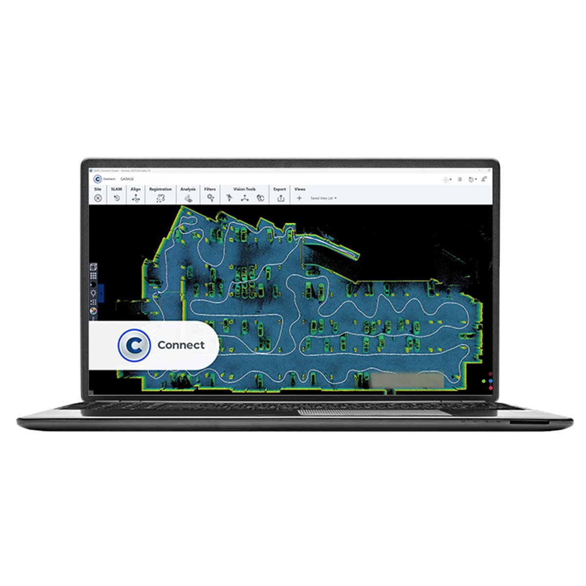
Dive into the world of FARO Connect, your ultimate software for handling 3D point cloud and image data with ease. Powered by GeoSLAM's cutting-edge SLAM algorithm, connect seamlessly processes local FARO Orbis data and connects you to the optional FARO Sphere® XG cloud platform, unlocking seamless viewing, sharing, and collaboration.
Unlock the true potential of your scans with CONNECT.
Intuitive Visualisations
& Insights
Witness your data come alive with Connect's robust 3D viewer. Explore digital replicas of your real-world environments, extracting immediate insights from every intricate detail. Enhance your data's clarity through automated filters that tackle outliers, noise, thinning, and transient points.
Say goodbye to tedious manual processes and hello to high-quality data in full colour.
Streamlined Workflows
& Analysis
Boost your productivity with Connect's automated workflows. Optimize your data further with automated change detection, and prepare it for additional analysis with a diverse range of export options. Discover a world of efficient data management and insightful exploration with FARO Connect.
Plus with Sphere® XG Virtual Reality (VR) View, you can immerse yourself in the captured data and experience a whole new level of evaluation and exploration.


Unleash the Full Potential of the Orbis Mobile Laser Scanner
Business Value of the Orbis Mobile Laser Scanner
Simplify your scanning process
Just a click and a walk is all it takes to collect valuable data effortlessly. Designed for usability, Orbis streamlines surveying tasks for everyone, no matter the industry. Now you can capture data in places you never thought possible before. Discover the ease and efficiency of Orbis.
Unlock Powerful Insights
Experience the next level of data capture with our cutting-edge 3D technology. Elevate your understanding and gain valuable insights into your projects. Stay ahead of the curve in dynamic industries like construction, by capturing data more frequently and comprehensively. Our user-friendly and portable solution seamlessly integrates into any job site, providing a constant stream of fresh insights to transform your decision-making and collaboration. Revolutionize your projects and deliverables with our synergy-driven approach.
Peace of Mind One-Year Warranty
At FARO, quality is at the core of everything we do. We meticulously design, build, and test our products to ensure top-notch performance. That's why we confidently offer a one-year warranty with every purchase, because we believe in the durability and reliability of our hardware. But that's not all - we also provide affordable extended service plans, so you can protect your investment and avoid any unexpected expenses. Trust in our commitment to your satisfaction and enjoy the peace of mind you deserve.
Ultimate All-in-one Mapping Solution
Compatible with a range of accessories including a monopod, car mount, backpack, and cradle, this versatile device is perfect for capturing every kind of terrain, from stationary scans to expansive landscapes. From mineshaft exploration to outdoor adventures, the Orbis has you covered. Discover the endless possibilities and take your mapping to the next level.
FARO Obris Mobile Performance
Hybrid Reality Capture with FLASH Technology
Upgrade your mobile scanning capabilities with Hybrid Reality Capture, featuring our cutting-edge FLASH Technology. Experience unprecedented mobile and stationary scanning accuracy and detail with Orbis, the ultimate scanning solution. Achieve unmatched speed, data clarity, and precision all in one comprehensive package. Elevate your scanning game to the next level with FARO's Hybrid Reality Capture and FLASH Technology.
Experience the Speed of the Future
Orbis Mobile Scanning Technology
Unleash the power of rapid data capture with Orbis. Our cutting-edge mobile scanning technology revolutionizes project timelines, allowing you to acquire accurate spatial data at an unprecedented pace. Say goodbye to traditional laser scanning and hello to Orbis, the solution that will propel you ahead in today's fast-paced world.
GeoSLAM's Cutting-Edge SLAM Algorithm
Unlock unparalleled results with GeoSLAM's revolutionary SLAM algorithm. Trusted by top professionals worldwide, our algorithm, powering the exceptional Orbis, has stood the test of time in the toughest of conditions for over a decade. Continual innovation fueled by valuable customer feedback ensures our algorithm consistently exceeds expectations, transforming projects across various industries.
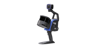
FARO Orbis Mobile Features
Effortless Scanning with Orbis
Weighing only 3.6kg, with the datalogger and battery included, Orbis is the ultimate tool for swift and hassle-free scanning of vast areas. No more cumbersome setups required!
Unparalleled Accuracy
Achieve a precision of 5mm with mobile scans and an impressive 2mm with stationary Flash scanning. Orbis is the top choice for those seeking ultimate accuracy in mobile scanning solutions.
Indoor and Outdoor Mapping
Whether you're working inside or exploring the great outdoors, Orbis has got you covered with a remarkable range of up to 120 meters. Say goodbye to limitations and embrace limitless possibilities with Orbis.
Accurately Map the Toughest Environments
Experience the unrivalled capabilities of Orbis - a cutting-edge solution crafted to conquer the most challenging environments. From underground mines to dense forests and construction sites, Orbis seamlessly maps any environment with precision and ease.
AEC, Mining and Geospatial Applications
Maximize Mining Efficiency and Safety
Put safety first. Orbis reduces risk to human life by minimising exposure to hazardous environments. With Orbis, you can confidently navigate your mine while safeguarding your team.
Capture stockpile volumetric calculations, track production progress, analyze convergence, and inspect vertical shafts with ease. Our impressive rate of data capture and range capabilities empower you to make informed decisions and optimise your mining operations.
Unlock the potential of your mine with Orbis. Experience unbeatable efficiency, maximize returns on your investment, and pave the way for a successful mining future.
Streamline AEC Data Capture and Collaboration with Orbis
Stay ahead of the competition with our cutting-edge solution for AEC projects. Orbis delivers fast and precise data capture, enabling you to track progress effortlessly on a monthly, weekly, or daily basis. Say goodbye to disruptions on the job site and hello to seamless analysis.
The Ultimate Data Capture Solution
Ideal for geospatial workflows and various applications, Orbis offers unmatched flexibility and precision. No matter the task at hand, whether it's dynamic scanning or meticulous Flash scans, our versatile solution delivers outstanding results every time.
Don't settle for anything less than the best. Choose Orbis and experience the synergy of speed, accuracy, and convenience.
Say hello to a new era of data capture!

Performance Specifications
| Performance Specifications | ||||||||
| Range | 120m | |||||||
| Points Per Second | 640,000 | |||||||
| Field of View | 360° x 290° | |||||||
| No. of LIDAR channels | 32 | |||||||
| Camera | Full 360° image of 8M pixels captured every second | |||||||
| Mobile Scanning | ||||||||
| Precision1 | 5mm | |||||||
| Trajectory & Mapping | Robust SLAM powered by GeoSLAM technology | |||||||
| Settings | Automatic Standard and Preset Processing Environments | |||||||
| Stationary Flash Scanning | ||||||||
| Precision1 | 2mm | |||||||
| Duration | 15 sec. including color | |||||||
| Resolution | 19M points (13mm @ 10m) | |||||||
| Registration | Real-Time and Fully Automatic with GeoSLAM technology | |||||||
| General Features | |||||||||||
| Environment | Indoor and Outdoor | ||||||||||
| Laser Class2 | Class 1, Eye Safe | ||||||||||
| Weight | Scanner: 2.10kg, Datalogger: 0.95kg, Battery: 0.55kg | ||||||||||
| Protection Class | IP 54 | ||||||||||
| Transport Case Dimensions | 500mm x 625mm x 250mm | ||||||||||
| Operating Temperature | 0° to +40°C | ||||||||||
| Manufacturer Warranty | 1 Year | ||||||||||
| Data | Point clouds with Intensity and Color, 360° Images, Trajectory | ||||||||||
| Raw Mobile Data Size | 350MB/min uncompressed | ||||||||||
| Flash Scan Data Size | 125MB | ||||||||||
| Desktop Processing | FARO Connect for Mobile and Flash Scans, FARO Scene for Advanced Registration | ||||||||||
| Cloud Processing | Fully automated with FARO Sphere XG | ||||||||||
| Output | Mobile scan: E57, LAS, LAZ, PLY, TXT Flash scan: E57 |
||||||||||
1 Given as one sigma | 2 Under IEC EN60825-1 | Specifications are subject to change without prior notice
Related Products
Sphere XG
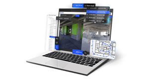
FARO Sphere XG is a digital Reality Platform that provides users with a centralised, collaborative experience across the reality capture applications and customer support tools through a secure, single-point sign-on process (SSO).
Focus Scanners
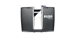
FARO Focus Premium and FARO Focus Core are the ultimate solutions for capturing precise, lifelike 3D models. Experience the power of creating stunning visuals in just minutes, regardless of challenging outdoor environments.
Orbis Mobile Scanner
Designed for industry professionals, Orbis streamlines project workflows reduces human error, and maximises productivity. With advanced stationary scanning capabilities powered by Flash and GEOSlam Technologies.